It was around midnight when I woke up with the sound of susurration. Eyes closed, I hoped it to be the glacial stream flowing nearby. I was wide awake, when I heard someone beating on the tent nearby. There was no doubt that it was snowfall. Our plan to cross the Pin Parvati pass tomorrow was in serious jeopardy.
Since past few years, I had been looking forward to go on Pin Parvati Pass trek. In fact, whenever my friends offered me come along to Kheerganga or Kasol, I had been politely declining by telling them that I’ll walk on that trail only when I am going for Pin Parvati Pass. I’ve always loved crossing the passes because of the transitions it offers in terms of the culture and sometimes landscapes. It has always felt to me like crossing from one country to another.
Pin Parvati Pass, is one of those treks in the Himalayas which offers a variety of landscapes, chance to witness different cultures and of course a decent enough altitude. It is supposed to be difficult than any other normal Himalayan trek because of the long trail and crevasses near the pass. I had been to Tarsar Marsar Lake just a few days ago. I still had some leaves left and it was an apt time for going on such a trek. It’s mid-September and trekking season in the Himalayas was nearing to an end.
Start of the trek
I was the last one to reach Barsheni. Rohit, our trek leader was waiting for me at Pulga Dam. After a short hike, we reached Kalga, a small village from where we were to start this trek the next day.
The dam at Pulga is part of Parbati Hydroelectric Project (Stage-II). It is a run-of-the-river scheme proposed to harness the hydro potential of the lower reaches of the river Parbati. The river is proposed to be diverted with a Concrete Gravity Dam at Village Pulga in Parbati valley through 31.52 Km long Head Race Tunnel and the Power House shall be located at village Suind in Sainj valley. Thus the gross head of 863 m between Pulga and Suind will be utilized for generating 800MW power. The diverted discharge of the river Parbati has been further augmented by diverting the discharge of various nullahs falling along the HRT alignment.
We had a round of introduction among trek mates. In our introduction, it was noticeable that most people are experienced trekkers. Some had a very impressive list of treks in their kitties and some had mountaineering experience as well.
Next morning before starting for Kheerganga, the first camping site; we were introduced to our trek guides Hari and Chetramji.
Initial 6 days are supposed to 5-6 hours of walk with not more than 500 meters of altitude gain.
We started from Kalga, with Parbati river on our left. On the other side of the river which receives more sunlight in the morning, Nakthan village. There were patches of cannabis plantation on the other side of the river. From Kalga, the trail climbs to a temple and small dhaba at Rudra-Nag waterfall, which is named after its resemblance of a snake. Our guide Hari tells us that local Devi-Devta(deities) come for a bath every year. Beyond Rudra-Nag waterfall, the trail ascends further through thick pine forests to the spiritual site of Kheerganga where Shiva is said to have meditated for 3000 years. The hot springs at Kheerganga are extremely important for Hindu and Sikh pilgrims as well as many others who believe the waters have sacred healing properties. The trail from Kalga to Kheerganga was broken at few places. There are always many people hiking towards Kheerganga. In the afternoon, we went for a bath in hot spring after pitching tents.

Khirganga (2789m) to Tunda Bhuj (3285m)
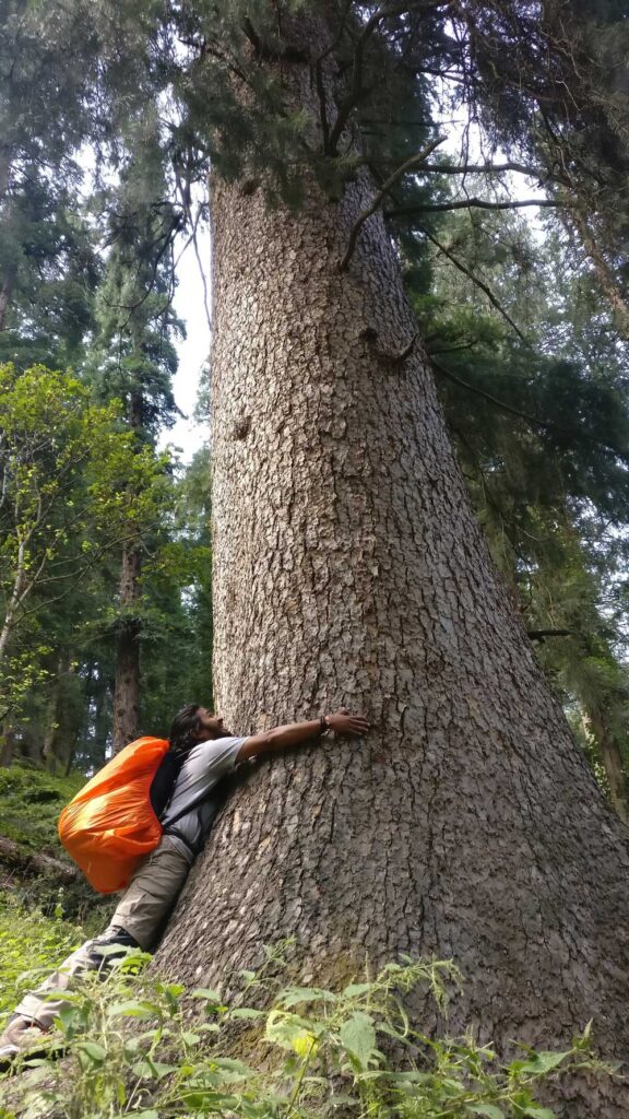
From Kheerganga to Tunda Bhuj (3285m) the Parvati river cuts a steep-sided gorge through the mountains and as the altitude increases, the thick, coniferous forest gradually gives way for patches of meadowland scattered with boulders.
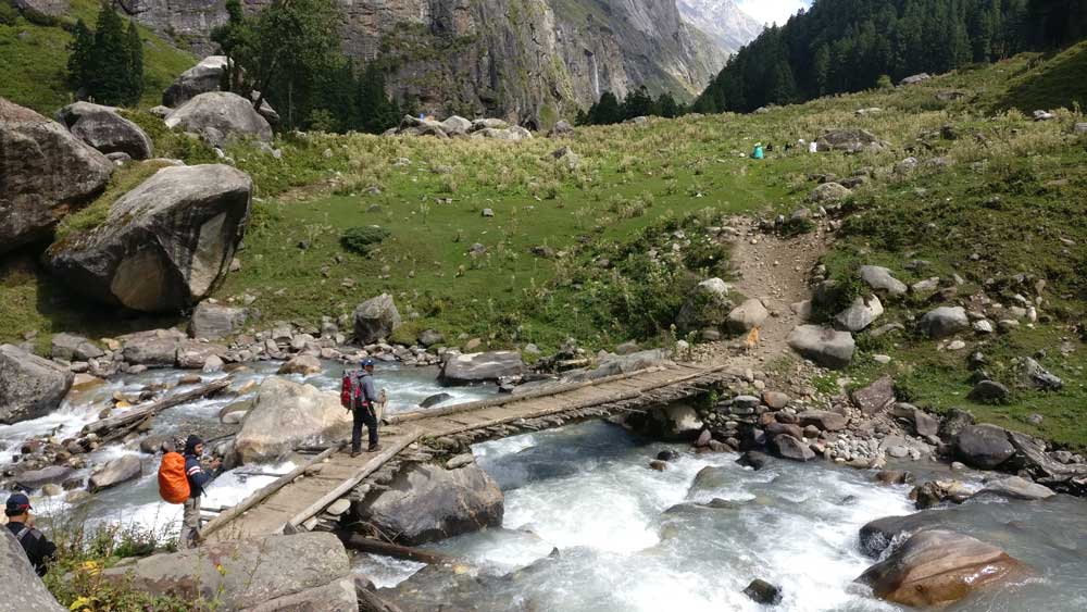
Near Tunda Bhuj, on the other side of the river many waterfalls emanating from steep mountains join the river. On those steep faces, shepherds in search of green pastures for their flock were seen passing across the waterfalls which we wondered if anyone would dare to traverse.

Waterfalls joining Parbati River from steep slopes of mountains on our left side.
Tunda Bhuj (3285m) to Thakur Kuan (3560m)
Today, the river flow close to the trail and one could hear the sound of it crashing its way through the rocks. The treeline begins to diminish and only some patches of bushes are to be seen. Along the trail, some Bhoj(Birch) trees could also be seen on the slopes of mountains which gives the name to the Tunda Bhuj campsite. After reaching Thakur Kuan campsite, we went for an acclimatization walk on a nearby hill.

There was another shepherd tent nearby with a big flock of sheep and goats. In our conversation, when we told that we have come from far places to trek in the valley, he was little surprised on why would someone make such effort and spend money to come this far and what is there to gain for us. Some of us were amused by the expression of faces of sheep and goats made good use of their mobile cameras.
Thakur Kuan (3560m) to Odi Thatch (3879m)
The trail goes across the river just after few minutes of walk. We had three hurdles to cross, a traverse along the steep rock face by the river and two natural bridges on the river. Our trek leader suggested us that we don our helmets as the traversal of the rock face and crossing the bridge could be tricky.
The bridges called as Pandu Pul, is a huge boulder placed right on the river. Local legend says it was placed by Bheem, one among Pandavas. The river flow beneath the rock through the small passage.
A rope was fixed on the bridge to prevent any slips.

We were also accompanied by a dog who had been following us from Kheerganga, even after several attempts by Hari and Chetramji, our local guides to leave it behind. During our short stops during the trek, many of us esp. Peter and Pratibha could be seen petting her. In return, she joined us for the nice pictures. It was even given a name “Jackie” and upon realizing the gender, some identified her by “Jacqueline” so that the name “Jackie” can still be relevant as hypocorism. Amusing, how we urban people in India, name our dogs. Names like Sheru and Moti become less and less relevant. Anyway, Jackie a faithful mountain dog whom we thought that she may not be able to cross the Pandu-Pul, and this is where we say our goodbye to her, traversed the slippery boulders like a cakewalk to join us. Everyone was cheerful.
After crossing the bridge, the valley opens up and is very wide with a more or less flat ground throughout. Glacial streams from both sides of the valley join the Parbati river. Odi Thatch(thatch = meadow), a wide flat ground by the side of Parbati River, could’ve been our campsite if water source was available in the vicinity. Porters had already gone ahead of Odi Thatch because of unavailability of water near the campsite. We followed them.

We continued further for an hour for our next camping site which was small flat land between the boulders, by the mountainside and very windy in the afternoon.

Odi Thatch (3876 m) to Mantalai (4100m)
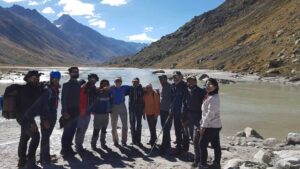
On today’s trail, valley expands further and the Parbati River now on our right side is calmer than before. In fact, we reach a point where the river flows on an almost flat bed of the wide valley creating sandbanks alongside. It is like any big river in plains with pebbles and sand around. In the sunny weather, it felt as if it was some kind of wonderland. Elated by the sight of the valley, we spent some quiet moment by the side of the river.
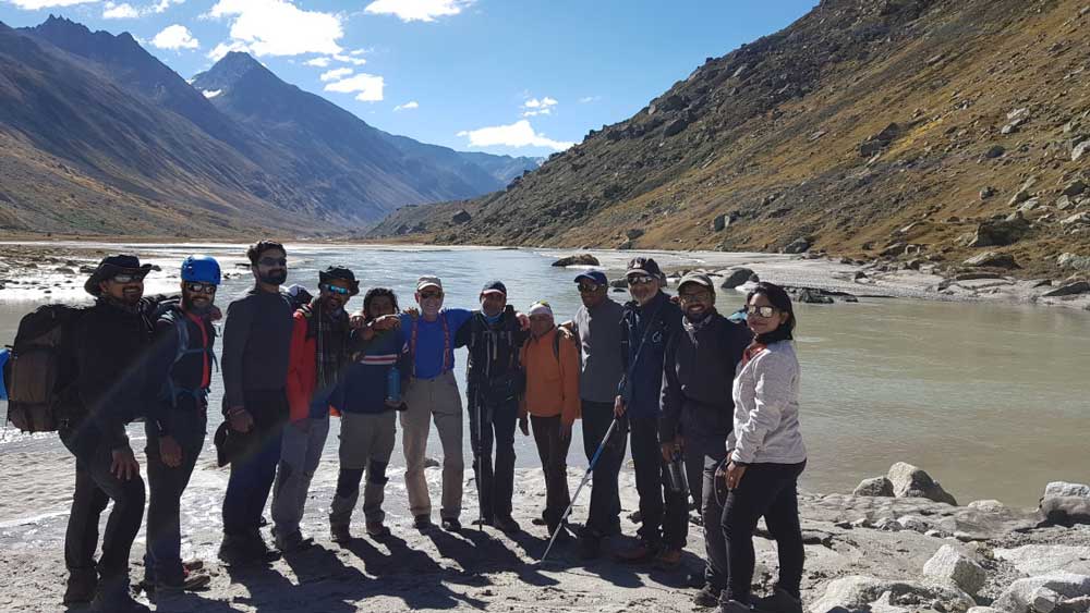
It was a perfect spot for a group photo and in fact, everyone was posing around.

Some of us went ahead and some decided to walk barefoot on the riverbed and enjoy while it lasts.


Parvati River at its widest

So far the weather was with us, but when we were nearing the Mantalai Lake, the starting point of Parbati River, the weather suddenly started closing in on us. It turned cloudy and windy which was giving us chills. While waiting for others, we visited the temple by the lake which houses a Shivling in the open air surrounded by cairns.

When we moved towards the next camping site, further up by the lake, a light rain started. As soon as we reached the campsite weather was again clear. Many of us attributed this sudden change in weather to the ritualistic prayers offered at the temple by the lake.
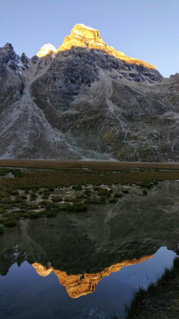
Mantalai (4100m) to Parbati Base Camp (4940m)
Weather was clear in the morning, and we were all ready for our highest altitude gain(~ 800m) of the trek. We start by climbing the mountain slope alongside the lake. It is a continuous climb and from the top we get the see the panoramic view of the lake. It was fascinating to see the different colors of small lakes formed in the Mantalai glacier. One would wonder how is it possible that these small lakes are so close to each other but have such difference in color. Some of these ponds seem to have turquoise blue and some were green in color and some had muddy appearance. I wonder about the physics and geology behind that.

After climbing the mountaintop by the lake, we pushed further through the morains crossing a stream coming from the glacier near the pass. The weather was with us so far. It was a bright sunny day when we reached base camp.

The campsite was some rocky patch between the boulders just before the thick tabletop like glacier. I took some time to wash in the glacial stream nearby while the sun was still with us. The peak overlooking the Mantalai lake was playing hide and seek in clouds and some of us amused by it, were busy capturing it in a time-lapse video. Sitting on a boulder, Ashish was busy creating a 360-degree view of the campsite.
We were left with only 300m of climb and everything seemed to be in our favor so far.
Around midnight, I woke up with a sound of susurration. I really hoped that sound to be of a stream flowing nearby. Maybe, the sound of the stream is more clear in the night, I thought. This is when I heard someone beating on the tent nearby. My worst fears had come true. It is snowfall! I had been waking every hour since then and the continued snowfall was adding to my fears. In such weather, they might actually decide to turn back and not cross the pass. It would’ve disappointing to turn back after coming this far and after so many days of trekking. I hoped that they decide to use the reserve day which we had in our plan if it is not advisable to cross the pass tomorrow.

Parbati Base Camp (4940m) via Pin Parbati Pass (5300m) to Shepherds camp (~ 4300m)
What was all rocky and dry yesterday, was covered with snow in the morning. Snowfall was incessant. Rohit, Hari, and Chetramji decided to march ahead instead of waiting the snow out. I overheard someone saying that we don’t have much kerosene oil left with us as well and going back will take longer. It is better to cross the pass before snow piles on. My hands were freezing in unpitching the tents and my thin fleece gloves were not helping either. We continued as per the plan. Hari was leading the way prodding along with a stick. After a few minutes on the snow, when glacier started, he suggested that we rope ourselves up as it’s become very difficult to identify the crevasses. It would’ve slowed the whole group if everyone was roped up, so three of us (Rohit, Har and me) roped up to move ahead making way for others. Hari was leading the way. It was complete whiteout below the pass.
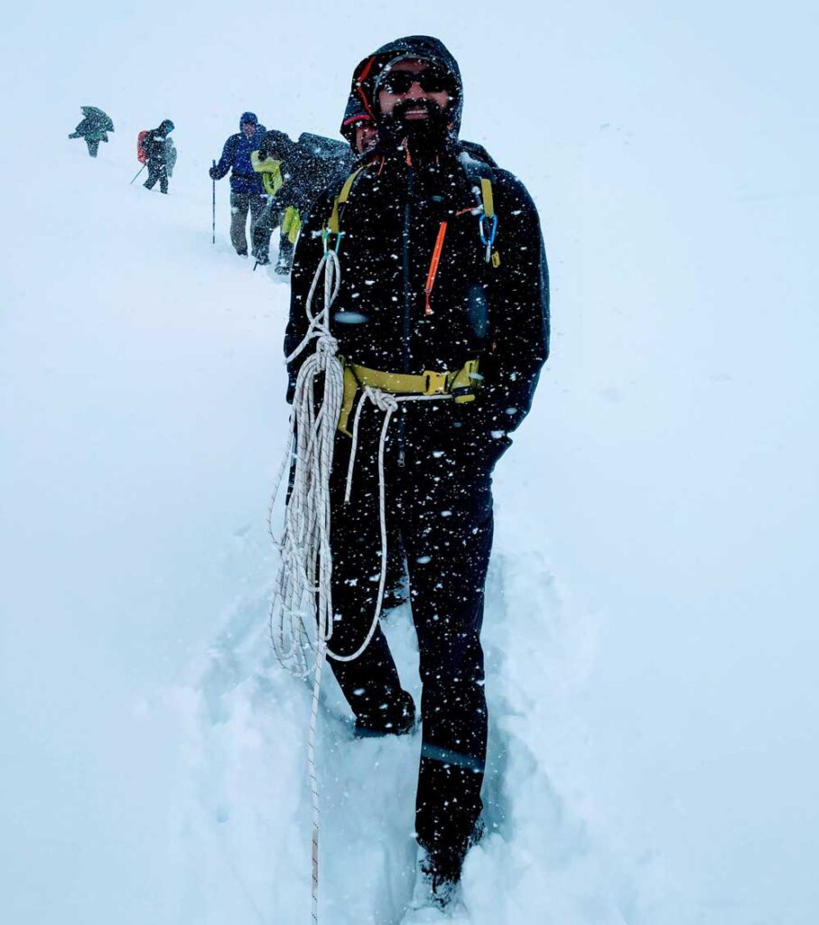
After negotiating the first crevasse, Cheeku who was the leader of the porter group was called upon by Hari to lead the way. Cheeku was crossing this pass sixth time this year. He knew this terrain as a back of his hand and was very instrumental in identifying the path and crevasses too. However, some porters who went ahead behind Cheeku did go in the crevasse but were pulled out in time. We were trying our best to negotiate the crevasses with the support of the makeshift arrangement of fixed ropes.

While working with the ropes, my thin fleece gloves were completely wet and I had to squeeze the water out of the gloves. It was freezing, and I hoped I didn’t get frostbite. Around 11:30, we touched the pass. There wasn’t much to see around in this incessant snowfall.

We had a long way ahead, so we hurried towards the other side of the pass in Pin Valley without staying much on the pass. There are many crevasses in the glacier at this side of the pass as well and these were now completely hidden by the snowfall. Whenever Cheeku identified a crevasse, a shout goes out to us three to take up positions on both sides of crevasse to fix the rope.
We had already decided to skip the usual camping site (Pin Basecamp) and keep going down to reach the next one, Shepherd’s camp. By the time we crossed the Pin river, our shoes and clothes were completely wet and it was becoming difficult to stand. I didn’t even bother to remove the socks to cross the river. It was better to keep walking to keep warm. When we reached the campsite, the dinner tent was set up. A stove was put to keep us warm. Snowfall was nowhere to stop.
I had hoped that Spiti would be dry at this time of year, but the weather was defying all the odds. We didn’t want to bother with pitching our tents and everyone except few decided to spend the night in dinner tent. In the night, Rohit came to us and said that he will start early next morning for Mudh and try to arrange a conveyance to pick others midway. I asked Rohit if I can be of any help and can accompany him to which he said yes. Before sleeping, I noticed that my sleeping bag along with everyone others was soaking wet too. I had put it in a dry pack which didn’t help. For tomorrow, we had decided to go to Mudh.
Shepherds Camp (~ 4300m) to Mudh (3800 m)
As per the plan, I started with Rohit around 8:30 towards Mudh. There was someone from porter group as well to show us the way. Hari and Chetramji were to follow the course with other members after some time. We needed to hurry to reach Mudh, else vehicle wouldn’t reach near the roadhead in time to pick others. The sandy and fragile soil in the mountains of Spiti Valley were frequently showing signs of landslide and sometimes we had to cross active landslides.

Our shoes were already wet and clothes were wet again. Around 11:30 we touched the roadhead. This is under construction road in the valley, and Mudh village is way ahead. Some more kilometers ahead from roadhead, there is a nullah (Pagal Nala) which flows over the road and the stream is so ferocious and strong that vehicles coming from Mudh can’t cross this stretch. We were supposed to bring the vehicle to this point. We crossed the Pagal Nala with on a small makeshift footover bridge down the stream. We had reached a landmark. On a normal day, this trek would’ve successfully ended here.
We started freezing when we stopped for lunch near Pagal Nallah. Ahead on the road of Pagal Nala, there were many small landslides and we wondered if a vehicle could reach here or not. It was a long and arduous walk and felt tougher than yesterday. Today was a definitely a long stretch, more than 25KM and it was again freezing in the afternoon. After hours of walking on the road along with Pin River, Mudh village was finally on the sight. Nevertheless, it took another hour to reach the village. There was another wide and ferocious stream was waiting for us just before the village. The sheer muddy color and the sound of it sent chills down the spine. Rohit took the lead and we held each other’s hand to cross the stream.
We reached Mudh around 3:30 PM. The only phone(BSNL satellite phone) available in the village wasn’t working. It had been snowing in the valley since last two days and phone works with solar-powered batteries only, which are dead by now. We asked the owner of the public telephone, who also owned a homestay (Tara) for help in arranging a vehicle to pick others along the trail. People in the village were surprised to listen to our story and even enquired if someone is already dead. Some went on to suggest that we were foolish to cross the pass. There were others stuck since 2 days waiting to go anywhere outside the village. The owner of Tara cafe muttered, “agar Gadi nhi gayi to wo log to mar jayenge”. He rushed to arrange two tractors and a JCB excavator to clear up the road. Rohit was frantically trying to contact Hari over the walkie-talkie. He was able to connect to Hari around 5:30 and Hari told us that everyone is safe. By 6:30, 3 more of trek mates along with some porters have arrived in the village but many were still left way behind. I was told by these guys that the tractor won’t be able to come back as there had been recent landslides. The helpful people of the village were waiting with tea and hot water on the road. They immediately took these guys in their homes and even offered dry clothes. It was already dark. I went with the JCB excavator again to see if I can be any help. I was already feeling guilty for not going along with the tractor. Riding the JCB, wading through the raging nullah; we caught up the tractors around a kilometer ahead waiting for help to come. There were two big landslides completely covering the road. While JCB started clearing the road, I walked ahead to see others. The guys on tractor told that everyone else has taken a shortcut to reach the village and must’ve reached the village by now. These guys were not willing to leave the tractor behind on the road in fear of landslides which may occur anywhere in the stretch. I waited till the JCB cleared the road and tractors (one without a headlight) were shown its way to the village. When I reached village again, everyone had reached already. The dog Jackie, who was following us had also reached in the village running behind the tractor and was safe in the village.
Two Days of waiting in Mudh Village

The snowfall had never stopped, but Rohit was able to convey the information about our safety the next day. We started getting news about the havoc this weather had created. The roads were closed everywhere and we had no other option than to wait till the road to Kaza(A popular place in Spiti and headquarter of Spiti subdivision) opens. These two days, we had a good time in the village enjoying what was available for us. After a day, the cafe was serving only their homestay guests as food had become scarce in the village. The weather was now clear after two days in Mudh. The road was getting repaired and we made our way to Kaza. The road to Manali via Rohtang pass was broken at many places and there was no sign of it getting repaired in near future. The road to Shimla via, Reckong Peo was open the next day and we made our way home.
With this last stretch of my road trip, I was heading back having collected the most memorable and cherishable memories, must say, a long due present to my own self.


